Current Littourati Map

Neil Gaiman's
American Gods

Click on Image for Current Map

Littourari Cartography
  • On the Road
    On the Road
    by Jack Kerouac
  • Blue Highways: A Journey into America
    Blue Highways: A Journey into America
    by William Least Heat-Moon

Search Littourati
Enjoy Littourati? Recommend it!


Littourati is powered by
Powered by Squarespace


Get a hit of these blue crystal bath salts, created by Albuquerque's Great Face and Body, based on the smash TV series Breaking Bad.  Or learn about other Bathing Bad products.  You'll feel so dirty while you get so clean.  Guaranteed to help you get high...on life.

Go here to get Bathing Bad bath products!

Entries in river (2)

Friday
Mar022012

Blue Highways: Jacobson, Minnesota

Unfolding the Map

We stop with William Least Heat-Moon (LHM) to skip rocks across the Mississippi.  Rivers are life, rivers are powerful, rivers are death.  Most of all, rivers are real and illusions at the same time.  Read on to find out why.  To find out where we cross the Mississippi this time (our fourth time in this journey), skip on over to the map.

Book Quote

"I came to the Mississippi again at Jacobson and stopped to get off the hot asphalt.  The river was wider here, and it took me three attempts to shy a rock across.  I walked up along the banks.  The Mississippi, not a hundred water miles from its source, already flowed in olive murkiness."

Blue Highways: Part 7, Chapter 11


Mississippi River near Jacobson, Minnesota. Photo by David Peterson and hosted at Panoramio. Click on photo to go to host site.

Jacobson, Minnesota

When I was very young, and we used to go to our property on the Noyo River in Northern California, I always wondered why the water looked green.

The river in the summer was small, meandering over rock and sand through redwood forest, with alder and oak trees lining the bank.  In sunlight, the river had an olive green look to it.  The water, depending on the depth, could look a brownish green in the light shade to a deep, dark green in the shade.  The water wasn't murky - in fact it was mostly clear so that rocks and objects on the river bottom could be seen quite easily, of course with a green hue.

It confused me because when I scooped the water out of the river, or got a bucketful, the water was clear like water should be.  But in the river, it clearly didn't look like clear water.  It had color, which gave it an otherness.  I knew it was water, because it splashed and flowed like water should.  But I wasn't quite sure, because it had that color.  It was as if the river were something else entirely.

Of course, my Noyo River introduced me to illusion even though I didn't know it.  Those of you reading will say "duh, Michael, the river bottom had that color and therefore the water looked like the same color.  But at five, or six, or even seven years old I didn't understand that.  All I knew is that water in the river looked different, and that it made a magical transformation into real water once you pulled it out of the river.

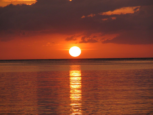
In fact, water is a master of illusion.  Put a pencil in a glass of water and watch how the light refracts so that the pencil appears to bend or even be broken.  Watch ocean water go from a bright blue in the midday sun to somber gray in the fog or under clouds, to mirrorlike glassiness on a calm day at sunset.  Which is it?  It's all three.

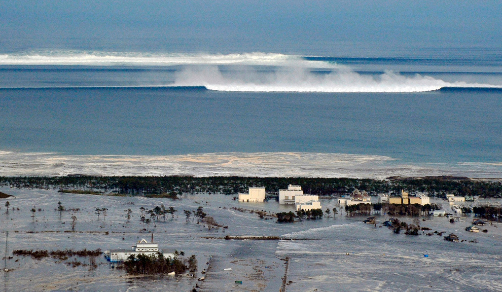
Water is probably the most powerful and destructive force we have on Earth.  I listen to, and am comforted by, the soft pattern of rain.  Yet that soft patter, if allowed to work for years or decades, will eventually find cracks in my ceiling, and entrances into my walls, and eventually ruin my house.  The mightiest and hardest stone may stand unyielding for eons, but over the millenia it will change and erode because of the constant battering of water.  We happily play in and splash water over each other, and yet water is a party to some of the most destructive occurrences on the planet.  Flooding caused by incessant rain, especially in low lying areas, or storm surges driven ashore by hurricanes, or tsunamis forced up by an ocean floor earthquake.

Look at a river like the Mississippi.  Not here, in Jacobson, Minnesota but farther down in Saint Louis or even New Orleans.  The surface seems to flow along at a slow, steady pace.  We have pictures in our mind, put there through literature, movies and television, of leisurely rafting along its surface.  Yet beneath the surface raging currents boil.  Logs are often sucked down, held under for a long time, and then suddenly come shooting to the surface, propelled by their own bouyancy and the river's forces.  In New Orleans, it is madness to jump into the river.  Many who have done so have disappeared, and only turned up miles downstream when the river decided to release its drowned captive from its cold embrace.

Water, in this way, is like a living thing with a mind of its own.  The Mississippi, until the Army Corps of Engineers dredged, channelled, leveed and locked it, tended to move around like a snake in the grass.  It would cut channels and happily flow by them for years or decades and then, suddenly overnight, break free through some weakness in the banks and cut a new channel.  Sometimes its changes would take whole villages or towns from riverfront to landlocked property overnight.  The mouth of the Mississippi has, throughout its history, moved from the Panhandle of Florida all the way over into Texas.

For example, look at this map picture of the Mississippi at Jacobson.

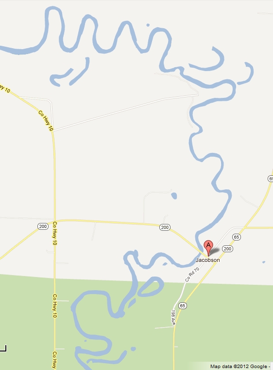
The map only hints at the wildness of the river.  Sure, the river twists and turns because water finds the most accessible route downhill.  There are some circles and some loops, called oxbow lakes, that don't appear to connect with the river.  But look now at a satellite view.  You can see what the map only hinted at.

This river has moved, a lot, in its past.  Channels have been cut and abandoned, leaving loops unconnected with the river, old channels that are dry, and river passages that end nowhere.  The system looks like a Gordian knot, or intertwining serpents.

The efforts of the Army Corps of Engineers currently keeps the Mississippi in its channel in its navigable length, but this is the elusive power of water and the river.  The maintenance has to be continual.  Water strains against all efforts to contain it.  The bulk of the Mississippi wants to move and twist along its bulk just like its tail twists and turns near its source.  Water may allow itself to be contained for a while, but eventually, water will always win.  All our dams, levees, channels and locks, built to contain and tame the river, will eventually crumble away.  All our efforts to control nature can only be temporary at best.  Water knows us, inside and out.  It is us, and because of this, it will always be more powerful than us.

Musical Interlude

A wonderful song about the Mississippi - or really any large river - written by Roger Miller for the musical Big River, based on the Adventures of Huckleberry Finn by Mark Twain.

If you want to know more about Jacobson

Lakes 'n' Woods: Jacobson
Rootsweb: Jacobson, Aitkin County
Wikipedia: Jacobson

Next up: Duluth, Minnesota

Thursday
Oct132011

Blue Highways: Astoria, Oregon

Unfolding the Map

We pass through Astoria, at the mouth of the Columbia River's titanic meeting with the sea, and think about that enormous river and the use of smallpox as early American biological warfare.  How does Oregon fit with that?  Read on, dear Littourati, read on.  Go to the map to locate Astoria, Oregon.

Book Quote

"The great sea reach of the Columbia ranges in width from about three miles to ten miles and was bridged just recently at Astoria.  When it comes to fall and force, no other American river can match this one; near its mouth, sudden whirlings of water will suck logs under only to spit them forty feet into the air....

"Astoria, the oldest city on the river and now an industrial center, began as a trading post established by John Jacob Astor's fur traders.  Soon after the founding, Indians gathered to annihilate the white men; one of Astor's partners, a devious man named Duncan McDougal, thought to save the company by threatening to uncork a black vial that he said held smallpox; the tribes quickly agreed to peace and Astoria survived...."

Blue Highways: Part 6, Chapter 5


Sunset between Astoria, Oregon and Washington State. Photo by Gene Daniels and hosted at Wikimedia Commons. Click on photo to go to host site.

Astoria, Oregon

A long time ago, traveling up Interstate 5 to Vancouver, Canada I passed over the Columbia River.  I was fifteen, and more concerned about getting my chance to drive on the freeway with my learner's permit (I never got that chance).  So what I'm saying is that I passed over this landmark without really noting it in my memory.  That was unfortunate.

Having lived along the Mississippi when I dwelt for a time in New Orleans, I have some experience of strong and powerful rivers.  The Mississippi, where it reaches New Orleans and slams up against the levees in a 90 degree turn at Algiers Point, is packing so much power behind it that it is actually higher on one side than the other by a few feet.  I can't find any confirmation of this but I believe it was told to me on some kind of tour.  The Mississippi is so powerful that you just can't jump in and swim it it - it will suck you under and carry you down.  Bodies might not surface for weeks until the river decides to let them go.  Tree trunks may surface suddenly after having been held down at the river's bottom for years.  In his classic Life on the Mississippi (a future Littourati subject), Mark Twain wrote of the Mississippi River and its character, how it might change course overnight, and how sandbars and logs that served as riverboat landmarks might suddenly disappear and reappear.

The Columbia River, on the other hand, seems like it might have a more wild flavor to it than the Mississippi.  It rises out of British Columbia, and flows northwest before making an almost complete 180 degree turn and heading south through Washington, where it again makes a 90 degree turn and heads west between Oregon and Washington to the Pacific.  It is the largest and longest river in the Pacific Northwest.

There's an interesting Native American legend involving the Columbia River, told by the Klikitat tribe.  A land bridge used to exist across the Columbia, caused by a giant landslide in the Cascade Locks area, which created a giant lake behind it.  Indians may have been able to cross the river on that bridge, which they called Bridge of the Gods.  Eventually, the water broke through and created the Cascade Rapids in the Columbia Gorge.  The Klikitat Indians explain these natural occurrences by relating that the chief of the gods and his two sons were traveling in the area and decided they wanted to settle there.  The chief shot his arrow in one direction, and one son went that way, and then he shot an arrow in the other direction, and his other son followed that.  He then raised the land bridge over the river so that he could get together with his sons.  Eventually, as is usual, the sons got into a fight over a woman.  Forests were leveled and villages were destroyed.  Angry, the chief of the gods turned one son into Mount Hood, the other into Mount Adams, and the woman became Mount St. Helens.

I love legends like this, as I explained before, when people explain through stories the natural phenomena they don't understand.  I also found very interesting LHM's story about Astoria's salvation from the hands of angry natives wanting to wipe it out.  The threat of smallpox was very real in historic America.  The disease was unknown in North America until Europeans brought it with them, and over the course of the next 200 years it decimated the Native American population.  The British supposedly used smallpox as a biological weapon during the French and Indian Wars by giving smallpox infected blankets to Indians under Chief Pontiac who were besieging them at Fort Detroit.

So, by the time of Astoria's founding, smallpox was very much a fear.  In fact, one of the characters in Astoria's history is a Kootenay womnan named Kaúxuma Núpika, or the Manlike Woman, who was a prophetess who said that the white men had changed her sex, and who got in trouble with her tribe by predicting smallpox.  She appeared in Astoria with a young woman she called her wife, and was there for a short period of time because her life was in danger.  That Duncan McDougall, then in charge of Fort George as Astoria was called for a time under the British, could take a small vial out in front of hostile Chinook chiefs and cow them into leaving the fort alone testifies to the fear that the native population had of the disease.  He was called "the great smallpox chief" and even later, some tribes feared that if they made any missteps that angered the whites the commander of the fort would level a plague at them.

Of course, nowadays biological warfare, even the threat of such, is outlawed by international law.  However, I understand that research was done to develop smallpox as a weapon only a few decades ago, and that stores of smallpox still exist in the US and Russia, as well as in North Korea.  The degrees of separation between a small city in Oregon and such topics such as biological weaponry is hard to imagine.  However, given that one man saw a threat and in turn threatened to loose upon his enemies a deadly disease and given that until 30 years ago biological weapons were considered to be valid weapons of war by governments (and some governments and groups might still consider them to be on the table in a crisis) shows that human nature hasn't changed much.

Musical Interlude

Did you know that the cult film (at least I call it a cult film) The Goonies was set in Astoria?  I must admit that I've never seen The Goonies, though I know it was the big break in the career of future Notre Dame icon and hobbit sidekick Sean Astin.  The following song, So Long, Astoria is from the soundtrack to that film.  It is by The Ataris and is also the title song to their album of the same name.

If you want to know more about Astoria

AstoriaOregon.com
Astoria-Warrenton Chamber of Commerce and State of Oregon Welcome Center
The Daily Astorian (newspaper)
El.com: Astoria
Port of Astoria
Wikipedia: Astoria

Next up: St. Helens, Oregon