Current Littourati Map

Neil Gaiman's
American Gods

Click on Image for Current Map

Littourari Cartography
  • On the Road
    On the Road
    by Jack Kerouac
  • Blue Highways: A Journey into America
    Blue Highways: A Journey into America
    by William Least Heat-Moon

Search Littourati
Enjoy Littourati? Recommend it!


Littourati is powered by
Powered by Squarespace


Get a hit of these blue crystal bath salts, created by Albuquerque's Great Face and Body, based on the smash TV series Breaking Bad.  Or learn about other Bathing Bad products.  You'll feel so dirty while you get so clean.  Guaranteed to help you get high...on life.

Go here to get Bathing Bad bath products!

Entries in Columbia (4)

Monday
Feb042013

Blue Highways: The Ending

Unfolding the Map

It's the end of the road for our Blue Highways adventure.  Even though the book ends with William Least Heat-Moon gassing up Ghost Dancing at New Harmony, Indiana for the final run to Columbia, Missouri and home, we know that he made it because he subsequently wrote other books.  Thank you, all of you Littourati, for reading my posts during my 2½ year journey through the book.  I'll be back in a few weeks with my next mapping project, whatever that may be!  In the meantime, here is the completed Blue Highways map!

Book Quote

"The circle almost complete, the truck ran the road like the old horse that knows the way.  If the circle had come full turn, I hadn't.  I can't say, over the miles, that I had learned what I had wanted to know because I hadn't known what I wanted to know.  But I did learn what I didn't know I wanted to know....

"....The pump attendant, looking at my license plate when he had filled the tank, asked, 'Where you coming from, Show Me?'

"'Where I've been.'

"'Where else?' he said."

Blue Highways: Part 10, Chapter 4


Columbia, Missouri and the end of the Blue Highways. Photo by CosmiCataclysm and hosted at Wikimedia Commons. Click on photo to go to host site.

Columbia, Missouri : The Ending

It's with some bittersweet feelings that I begin this post.  On May 17th, 2010 I started this project to map and to explore my thoughts. feelings and emotional reactions to Blue Highways.  The concept remained simple, and followed neatly from my previous explorations into On the Road.  I would map Blue Highways, and write about whatever moved me from the reading.  This would provide a geographical map of Blue Highways, and also a map for me (and whomever else was interested) of my inner emotional geography and thought process.

Little did I know that this project would consume 2½ years, constitute 375 mapped points and 318 posts.  I could have never fathomed that, since I wrote a rough average of 1000 words per essay, I would easily write at least 318,000 words or more.  Nor did I know just what depths of my emotions and my knowledge, and in many cases my curiosity, I would sound in my journey through Blue Highways.

The fruits of my project have been, for me, overwhelmingly positive.  I feel that I've become a better writer and essayist, though I realize that the quality most likely varies from post to post.  I also loved immersing myself so completely into a book.  What the reader has seen in Littourati has been my thoughts and feelings that have been dredged up through William Least Heat-Moon's skillful and polished prose.

Littourati has also become more well-known on the internet.  Someone, I have no idea who, has put a link to Littourati on the Blue Highways Wikipedia page.  I've received the occasional comment of support and visits from all over the world.  I can only hope that what I've put down in these Blue Highways posts resonates with readers.  I've also added some additional small embellishments, like the "Musical Interlude" where I insert songs that I believe relate to the posts, photos of the towns and pictures of symbols of the state.

I'm very thankful to William Least Heat-Moon for writing Blue Highways and providing me with so much inspiration.  If he knows about Littourati and my efforts to map his book, I hope he approves.  I have never meant to diminish Blue Highways, but to celebrate it, and I hope that is evident.

My life's journey has progressed in the time since started mapping Blue Highways.  My job has changed, I'm buying a house for the first time, and there have been numerous joys and heartbreaks that I've experienced.  In other words, life has occurred.  One thing that has helped me through these ups and downs has been knowing that 2-3 times a week, I had posts on Blue Highways to do.  You, as the reader, have come along with me through some of those ups and downs, just as I have accompanied William Least Heat-Moon, circa 1980 or so, on his journey.  I don't know if I feel I've come full circle, because like he writes, I didn't know what I wanted to know.  That's been my joyful discovery during this process - those things I didn't know that I wanted to know.

What will I do, now that Blue Highways is over?  First, I have some unexpected, pressing personal business to attend to.  Then I must update my knowledge on Google Maps because its version has changed during my Blue Highways effort and I want the next project to utilize the latest version.  And finally, I need to pick my new project.  I have three in mind:

  1. Neil Gaiman's American Gods, where I would map the physical and spiritual journey of the main character Shadow (as well as my own feelings on spirituality and religion).
  2. Jules Verne's Around the World in 80 Days in conjunction with pioneering female investigative journalist Nellie Bly's effort to beat Phileas Fogg's (fictional) record in her around the world effort in the late 1800s, and Elizabeth Bisland's efforts to beat Nellie Bly at the same time as Bly's journey by traveling in the opposite direction.
  3. Mark Twain's Life on the Mississippi in conjunction with Eddy Harris' solo trip by canoe down the Mississippi in his book Mississippi Solo.

So many possibilities!  If you have a preference, or a journey that I haven't thought of, please feel free to leave a comment and let me know what you think.  I want to be back with my next project in late February.

Finally, I want to thank everyone who has visited this site.  Littourati would be nothing if you didn't visit.  At last count, the average is about 125 unique people per day, and about 231 hits per day.  I still find it astounding that technology allows one to reach so many people now with just a click of a mouse.  As you might have gathered in many of my posts, it's the blessing and curse of modern technology.  But, in this case, I have only found blessings.

Musical Interlude

I will end the Blue Highways posts with a song I just discovered: Eddie Vedder's End of the Road from the Into the Wild soundtrack.  I was leery, given how Into the Wild ends, but the lyrics really fit the end of Blue Highways.

If you want to know more about Blue Highways or William Least Heat-Moon

William Least Heat-Moon has written many other fine books since Blue Highways.  I was enchanted by PrairyErth, an in-depth look at Chase County, Kansas.  He also wrote another road travel book called Roads to Quoz, and a water-travel book called River Horse.  Please consider reading more from this accomplished author.

Audio interviews with William Least Heat-Moon
Booknotes interview with William Least Heat-Moon
In Depth with William Least Heat-Moon
Onpoint interview with William Least Heat-Moon
University of Missouri Museum of Anthropology: Ghost Dancing (the Blue Highways van)
Wikipedia: William Least Heat-Moon
WorldHum interview with William Least Heat-Moon

Next up: Wherever the Journey Takes Us!

Tuesday
Nov082011

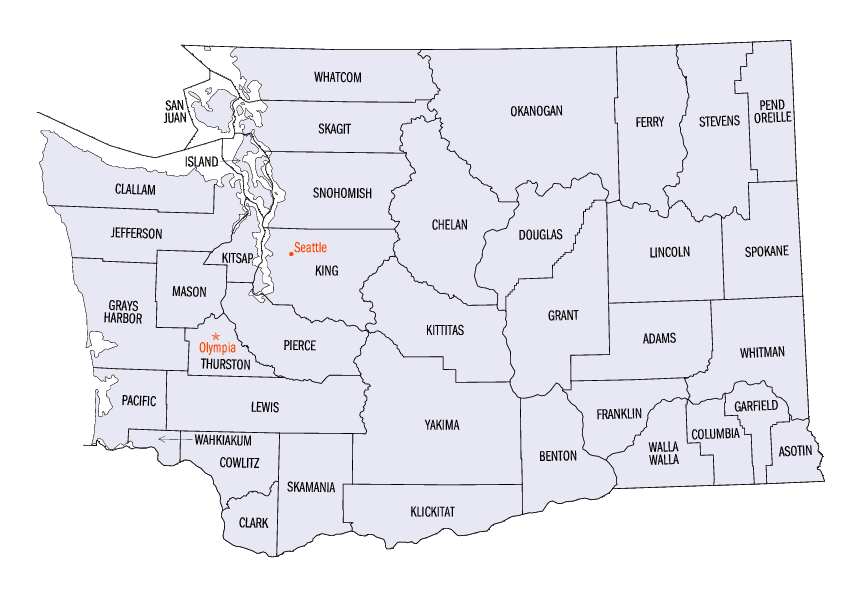
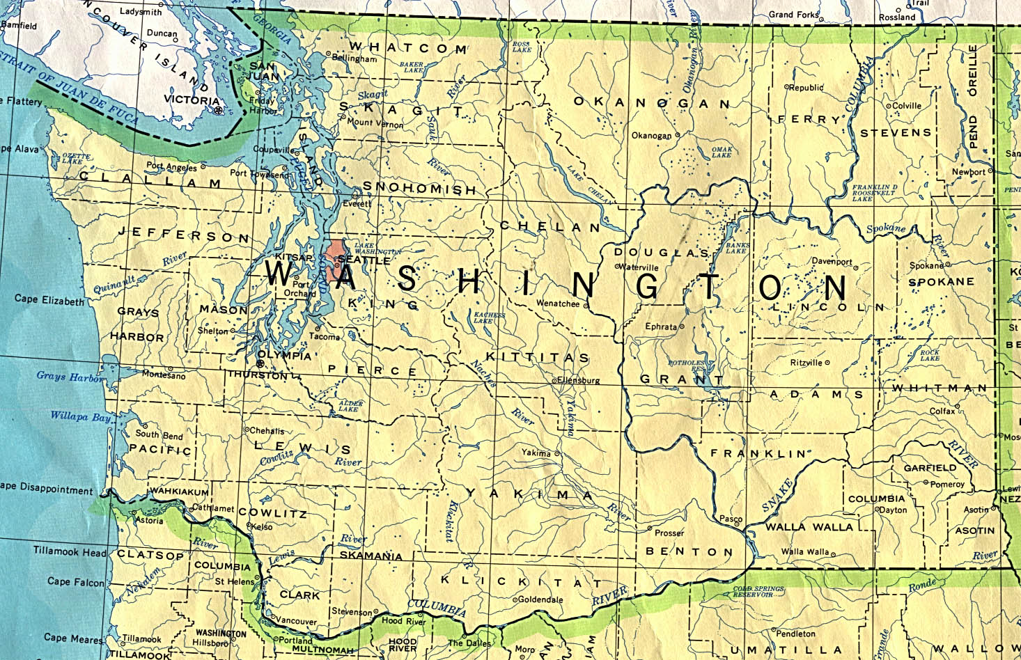
Blue Highways: Stonehenge on the Columbia, Washington

Unfolding the Map

I feel like this post might ramble a bit, but I think LHM was really trying to make sense of time and space and put it all together in the context of his trip.  I don't think he expected to run into a replica of Stonehenge in southern Washington, and frankly, I didn't expect that we'd have such a thing either.  I mean, I know that there is Carhenge, made out of cars, and there is a henge made out of old refrigerators. But a full replica?  That's pretty cool.   To see where Stonehenge on the Columbia sits, see the map - be sure to zoom in with satellite mode to actually see it!

Book Quote

"A little before sunset, in the last long stretch of light, I saw on a great rounded hill hundreds of feet above the river a strange huddle of upright rocks.  It looked like Stonehenge.  When I got closer, I saw that it was Stonehenge - in perfect repair....

"....In truth, the circle of menhirs was a ferro-concretehenge, but it was as arresting on its hill as the real Stonehenge on Salisbury Plain."

Blue Highways: Part 6, Chapter 9

Stonehenge on the Columbia River, near Maryhill, Washington. Photo by Gregg M. Erickson and in the public domain at Wikimedia Commons. Click on photo to go to site.

Stonehenge on the Columbia, Washington

There is an awful lot of self-reflection on the part of LHM in this chapter when he finds Stonehenge on the Columbia.  It affords us a good time to do some reflection as well.  I'll give a short synopsis of what LHM reflects upon.

When he finds this Stonehenge, quite unexpectedly, LHM is first struck by the convergence of past and present, which happened to him once before at the Navajo petroglyphs of Hickison Summit.  He remarks that this Stonehenge was built by a Sam Hill to commemorate the sacrifice of American doughboys in World War I, and how some graffiti on the monument gave it a kind of historical authenticity even though it was simply a mask of another more authentic monument far away.  He finds a Polaroid of a naked woman posing by some of the stones...her pendulous-breasted pose in the fading light hearkens to something more primal and elemental.

LHM then discourses on time.  He discusses how when we look at the stars that we look into the past, and speculates that when a telescope is built that can look back to the beginning of the universe, astronomers will be looking at the beginning of time and at the matter that now makes up the human race.  The original Stonehenge, he says, was an attempt at a time machine, one that could take the starlight - straight out of the past - and use it to predict future seasons and astronomical phenomena.  He begins to connect all that he sees around him in the universe and concludes that to escape his ego, that narrowness of now, and achieve concord or union with all things he has to reach outward - to embrace the past and the future.

I remember having this sense of things interconnecting in, of all places, New York City at the Metropolitan Museum of Art. There, in a wing all its own, is the reconstructed Egyptian Temple of Dendur.  This temple was given to the United States by the Egyptian government because it was to be submerged by the waters of the Aswan High Dam and because the United States had assisted in rescuing other sites of archeological significance.  One thing that captured my attention when I saw it was the grafitti on the temple.  One in particular stood out - an inscription by a man in the 1800s who was from Brooklyn.  I can imagine that, in the middle of the African desert, the man who carved his name into the temple in the 1800s thought that it would remain there in perpetuity.  Instead, his name ended back up in New York City three generations later.  I laughed at the irony of it all, a cosmic irony that shows that nothing in our world is permanent and fixed even when we "build it to last forever."  I realize now that the places that I've carved my name, physically and in the virtual world, will also fade over time and that any remembrance of me might also end up being a delicious bit of irony if it survives at all.

I am also struck by how the original structure of Stonehenge, in England, was built as somethat that was functional.  We are still trying to decipher the exact function of Stonehenge, but theories include an astronomical observatory, a religious center, a place of healing and a place of burial.  However, nobody quite knows.  Regardless, it did perform a function, and in its longlasting mystery gained prominence as the last remnant of a millenia-long-dead and unknown culture.  In a way, it serves as a gravestone for that culture it represents, and its mystery is the epitaph.

On the other hand, the Stonehenge on the Columbia was built specifically as a memorial.  It has no other function.  There is no mystery.  It was never used as an observatory other than those who, like LHM, looked out at the stars and pondered the mystery of time and space from within its concentric circles.  It is not used to predict planting and harvesting seasons, or to foretell eclipses.  We have much better ways for doing those functions now.  Nobody brings themselves or their loved ones to Stonehenge on the Columbia for healing, unless somehow the hope of the founder in establishing the memorial somehow has some healing effects on long-standing and vanishing pain from the First World War.  Sam Hill, who built the monument, was mistakenly told that the original Stonehenge was used as a sacrificial site and he wanted to memorialize the young men of Klickitat County, Washington who were sacrificed to the god of war.

There are many places of past function that have turned into monuments.  Almost every monument we are left with once had function.  Yet, I have to wonder if the functional structures that we have built today, our modern buildings of concrete and steel, will one day become monuments.  Just as the pyramids rise above Egypt, will our Empire State Building and Sears Tower, or their remains, become tourist sites for tourists trying to capture a dead culture.  Just as we read about the Alexandria Lighthouse, which was one of the Seven Wonders of the Ancient World, will people in the future be awed when they learn about the Golden Gate Bridge, a monument to our civilization's current and maybe past greatness?

I've never heard of a monument turning back into something functional in other ways.  That was before I went to the Star Axis in New Mexico.  It is a work of art being built into the side of a mountain.  Aligned with the axis of the earth, it allows one to walk through past alignments of the Earth with the stars, and future alignments also.  Because the Earth wobbles on its axis, the North Star of the time of the Egyptian pyramids was a different star, Thuban, than our North Star today, Polaris, which is different from the North Star of 10,000 years from now, Vega.  I wonder if after our civilization is dead, and if there is a time when humanity enters a period not unlike the Dark Ages when knowledge is not widely disseminated as now but is perhaps kept alive by small groups devoted to learning, if this huge sculpture will become functional and serve a purpose other than as a sculptor's long-envisioned project?

If we look to the past, we can certainly take pride in our accomplishments as a civilization.  We see where we've come from and how we've progressed.  But we can also possibly see our future in the past.  Civilizations die, and are replaced by new civilizations, just as if we gaze into the cosmos, we look into the past and see our future in the stars that have been born and have died before our star and world existed.  We live in the now, and think it will never end, but all that seems permanent will fade.  As LHM says, our present will become our past and our future will become our present, and try as we might to fight it, change renders all impermanent.

Musical Interlude

One of the funniest scenes in the mock-documentary, or rockumentary, called This is Spinal Tap is the scene where the titular band performs their song Stonehenge.  I am putting the full version of the song here, but if you want to see the scene in the movie where the band's grandiose plans to have a giant version of Stonehenge lowered to the stage end up hilariously wrong, look at this YouTube video.


If you want to know more about Stonehenge on the Columbia

Columbia River Images: Stonehenge
Images of Columbia River Stonehenge
Legends of America: An American Stonehenge in Maryhill
Wikipedia: Maryhill Stonehenge

Next up: Maryhill, Washington

Wednesday
Oct262011

Blue Highways: North Bonneville, Washington

Unfolding the Map

The gorge of the Columbia River and its tributaries is great for damming, and William Least Heat-Moon (LHM) runs across the first of the dams, Bonneville Dam, as he travels upriver in Ghost Dancing.  I will look at the costs and benefits of dams, from their clean energy production to their social and environmental effects.  Go to the map to locate North Bonneville in the context of the Blue Highways journey.

Book Quote

"At North Bonneville, the first of the immense dams that the Corps of Engineers has built on the Columbia at about fifty-mile intervals, thereby turning one of the greatest rivers of the hemisphere into staircase lakes buzzing with outboards....

"....Dams are necessary, the Corps maintains, and you can't argue necessity; nevertheless, I don't think Lewis or Clark or the old Chinooks would care much for Bonneville.  But then, like the wild river, they are dead."

Blue Highways: Part 6, Chapter 7


Bonneville Dam. Photo at the Washington Department of Ecology. Click on photo to go to host page.

North Bonneville, Washington

As I wrote in my previous post, the 1930s were an era of massive public works projects put in place by the Roosevelt administration to help pull the US out of the Great DepressionThe idea was that if government spent a lot of money to put people to work building roads, bridges and dams (as well as commissioning other types of public works), this would put money into the pockets of ordinary Americans, who would spend the money and thereby increase demand in the economy.  This would, in turn, stimulate greater investment as businesses restarted or opened to meet that demand.

The series of dams built along the Columbia River in the Pacific Northwest were part of a number of these projects.  The idea was simple if not massive.  If the massive water flow through the Columbia was harnessed, it could provide power for an entire region.  Construction of the dams would put thousands of people to work and put money in their pockets as well as stimulate business.  The result was a series of what LHM calls a series of "staircase lakes."

The dams have certainly provided power.  According to the Bureau of Reclamation, about 80 percent of the electricity in the state of Washington is created by hydropower dams on the Columbia and its tributary rivers.  With this electricity has come development, in fact, without the electricity one might be able to say that Washington would be a rural state with little industry.  Folk-singer Woody Guthrie, commissioned by the Bonneville Power Administration during the construction of the Columbia dams to write songs praising their utility, fully endorsed this type of development during the Depression.  To him, dams meant industry and industry meant work for millions of economically distressed Americans.  Other nations have used their water resources to spur development and provide their energy needs.  Rising economic power China is the largest producer of hydroelectric power - and its Three Gorges Dam on the Yangtze River has the largest electricity generating capacity and is second in overall output to Itaipu Dam between Brazil and Paraguay because of seasonal water flow variance.

Of course, dams have their downsides also.  Advocates of wild rivers, or rivers in their natural state, lament the loss of so many rivers to this type of development.  LHM makes a nod to this view when he states that Lewis and Clark, and the old Chinooks who fished the Columbia River, would not like the Bonneville Dam.  However, it is ironic that at least in the case of the Bonneville Dam, it is situated near where an ancient landslide made a natural dam that blocked the Columbia River for some centuries, until it eventually broke through and washed away the debris.

In order to settle and develop rivers, the rivers had to be tamed somewhat, but wild rivers left to their devices were a seasonal provider of river sediment which enriched the native soils and created fertile ecosystems for animals and humans.  Today, the mantra is to put levees, dikes and dams in place so that the rivers stay in their places, at some environmental cost. 

Another downside is that dams can impede the seasonal run of spawning fish, even if accommodations are made for them.  Bonneville Dam, for instance, has a fish ladder to allow spawning salmon to run past the dam.  LHM argues in this chapter, however, that 10 percent of salmon are lost and fish suffer from a variety of maladies caused by high nitrogen content that the dam's spillways introduce into the water. 

The flooding of areas behind the dam also comes at great cost.  Some of the cost is due to the loss of irreplaceable natural features.  When the Glen Canyon Dam was finished in 1966, it flooded a stunning area of slot canyons and other geological features that will never been seen again.  The building of O'Shaughnessy Dam in California for San Francisco's drinking water supply was opposed by John Muir and other naturalists.  When they lost the battle, California lost a valley, Hetch Hetchy, that by all accounts was as stunning as its neighbor Yosemite Valley.  Communities can be affected as well.  There have been many accounts written of the 1000 towns, villages and even cities that have been or are being submerged by the Three Gorges Dam, which has displaced over one million people.  Even dam projects in the United States came at social cost - some 3000 people were evicted from their homes because of the Columbia's Grand Coulee Dam, and the town of Roosevelt was lost due to the construction of the John Day Dam on the Columbia. There are many other "drowned towns" around the United States.

The other cost can be a way of life.  When the building of the Columbia River dams disrupted fish runs, it also disrupted Native American traditional fishing grounds.  Since a primary source of food and income was affected, these communities have felt wide ranging social effects from the loss of this primary livelihood.

Dams are also popular politically - it's a long-term project that a congressman or senator can bring home to his or her constituents.  To have the Army Corps of Engineers or the Bureau of Reclamation come into a state, plan and build a dam, and bring in federal dollars for the project can be a great short-term economic stimulus and gives politicians something to brag about at election time.  Yet there can be costs to that as well.  Though the New Orleans tragedy was not caused by a dam, the Army Corps of Engineers appears to be responsible, though it has denied this, for some catastrophic levee failures in New Orleans during Hurricane Katrina due to a lack of oversight.  Other issues include the "greening" of places not meant to be green and the allocation of water.  Despite some spectacular dams in the western United States that have put communities in the middle of deserts and made millions of acre feet of water available for agricultural use, the Southwestern United States is and will remain a desert.  The effects of dwindling water supplies throughout the southwestern states due to drought and overuse are only now beginning to be felt.  There are some that forecast that a cause of some major future world conflicts will be over access to fresh water - just watch what happens in the Middle East as Israel and its Arab neighbors all fight with each other over access to water.

"Roll on, Columbia, roll on" sang Woody Guthrie in the 1930s.  His was an optimistic look at all of the benefits the river could bring if we just dammed it and used it.  In the early 1980s, when LHM was passing through, there was a budding sense that maybe we'd dammed too much.  As we now pass through the early part of the 21st century, dams are a conundrum.  They provide clean energy but still have environmental and social consequences.  Some want to "undam" the rivers, but others want to continue to use this natural resource until we can find other cost-effective clean energy measures as alternatives to coal and oil.  Perhaps we're not too damned using dams, but maybe we'll discover another way so that the rivers one day can again run wild.

Musical Interlude

I mentioned him in the post so I might as well use him as the musical interlude.  Here's Woody Guthrie, the famous American folk-singer, with Roll On Columbia.

If you want to know more about North Bonneville

City of North Bonneville
Columbia River Images: North Bonneville
Wikipedia: North Bonneville

Next up:  White Salmon and Appleton, Washington

Thursday
Oct132011

Blue Highways: Astoria, Oregon

Unfolding the Map

We pass through Astoria, at the mouth of the Columbia River's titanic meeting with the sea, and think about that enormous river and the use of smallpox as early American biological warfare.  How does Oregon fit with that?  Read on, dear Littourati, read on.  Go to the map to locate Astoria, Oregon.

Book Quote

"The great sea reach of the Columbia ranges in width from about three miles to ten miles and was bridged just recently at Astoria.  When it comes to fall and force, no other American river can match this one; near its mouth, sudden whirlings of water will suck logs under only to spit them forty feet into the air....

"Astoria, the oldest city on the river and now an industrial center, began as a trading post established by John Jacob Astor's fur traders.  Soon after the founding, Indians gathered to annihilate the white men; one of Astor's partners, a devious man named Duncan McDougal, thought to save the company by threatening to uncork a black vial that he said held smallpox; the tribes quickly agreed to peace and Astoria survived...."

Blue Highways: Part 6, Chapter 5


Sunset between Astoria, Oregon and Washington State. Photo by Gene Daniels and hosted at Wikimedia Commons. Click on photo to go to host site.

Astoria, Oregon

A long time ago, traveling up Interstate 5 to Vancouver, Canada I passed over the Columbia River.  I was fifteen, and more concerned about getting my chance to drive on the freeway with my learner's permit (I never got that chance).  So what I'm saying is that I passed over this landmark without really noting it in my memory.  That was unfortunate.

Having lived along the Mississippi when I dwelt for a time in New Orleans, I have some experience of strong and powerful rivers.  The Mississippi, where it reaches New Orleans and slams up against the levees in a 90 degree turn at Algiers Point, is packing so much power behind it that it is actually higher on one side than the other by a few feet.  I can't find any confirmation of this but I believe it was told to me on some kind of tour.  The Mississippi is so powerful that you just can't jump in and swim it it - it will suck you under and carry you down.  Bodies might not surface for weeks until the river decides to let them go.  Tree trunks may surface suddenly after having been held down at the river's bottom for years.  In his classic Life on the Mississippi (a future Littourati subject), Mark Twain wrote of the Mississippi River and its character, how it might change course overnight, and how sandbars and logs that served as riverboat landmarks might suddenly disappear and reappear.

The Columbia River, on the other hand, seems like it might have a more wild flavor to it than the Mississippi.  It rises out of British Columbia, and flows northwest before making an almost complete 180 degree turn and heading south through Washington, where it again makes a 90 degree turn and heads west between Oregon and Washington to the Pacific.  It is the largest and longest river in the Pacific Northwest.

There's an interesting Native American legend involving the Columbia River, told by the Klikitat tribe.  A land bridge used to exist across the Columbia, caused by a giant landslide in the Cascade Locks area, which created a giant lake behind it.  Indians may have been able to cross the river on that bridge, which they called Bridge of the Gods.  Eventually, the water broke through and created the Cascade Rapids in the Columbia Gorge.  The Klikitat Indians explain these natural occurrences by relating that the chief of the gods and his two sons were traveling in the area and decided they wanted to settle there.  The chief shot his arrow in one direction, and one son went that way, and then he shot an arrow in the other direction, and his other son followed that.  He then raised the land bridge over the river so that he could get together with his sons.  Eventually, as is usual, the sons got into a fight over a woman.  Forests were leveled and villages were destroyed.  Angry, the chief of the gods turned one son into Mount Hood, the other into Mount Adams, and the woman became Mount St. Helens.

I love legends like this, as I explained before, when people explain through stories the natural phenomena they don't understand.  I also found very interesting LHM's story about Astoria's salvation from the hands of angry natives wanting to wipe it out.  The threat of smallpox was very real in historic America.  The disease was unknown in North America until Europeans brought it with them, and over the course of the next 200 years it decimated the Native American population.  The British supposedly used smallpox as a biological weapon during the French and Indian Wars by giving smallpox infected blankets to Indians under Chief Pontiac who were besieging them at Fort Detroit.

So, by the time of Astoria's founding, smallpox was very much a fear.  In fact, one of the characters in Astoria's history is a Kootenay womnan named Kaúxuma Núpika, or the Manlike Woman, who was a prophetess who said that the white men had changed her sex, and who got in trouble with her tribe by predicting smallpox.  She appeared in Astoria with a young woman she called her wife, and was there for a short period of time because her life was in danger.  That Duncan McDougall, then in charge of Fort George as Astoria was called for a time under the British, could take a small vial out in front of hostile Chinook chiefs and cow them into leaving the fort alone testifies to the fear that the native population had of the disease.  He was called "the great smallpox chief" and even later, some tribes feared that if they made any missteps that angered the whites the commander of the fort would level a plague at them.

Of course, nowadays biological warfare, even the threat of such, is outlawed by international law.  However, I understand that research was done to develop smallpox as a weapon only a few decades ago, and that stores of smallpox still exist in the US and Russia, as well as in North Korea.  The degrees of separation between a small city in Oregon and such topics such as biological weaponry is hard to imagine.  However, given that one man saw a threat and in turn threatened to loose upon his enemies a deadly disease and given that until 30 years ago biological weapons were considered to be valid weapons of war by governments (and some governments and groups might still consider them to be on the table in a crisis) shows that human nature hasn't changed much.

Musical Interlude

Did you know that the cult film (at least I call it a cult film) The Goonies was set in Astoria?  I must admit that I've never seen The Goonies, though I know it was the big break in the career of future Notre Dame icon and hobbit sidekick Sean Astin.  The following song, So Long, Astoria is from the soundtrack to that film.  It is by The Ataris and is also the title song to their album of the same name.

If you want to know more about Astoria

AstoriaOregon.com
Astoria-Warrenton Chamber of Commerce and State of Oregon Welcome Center
The Daily Astorian (newspaper)
El.com: Astoria
Port of Astoria
Wikipedia: Astoria

Next up: St. Helens, Oregon