;)


Blue Highways: Kaplan, Louisiana
 Email Article
 Unfolding the Map
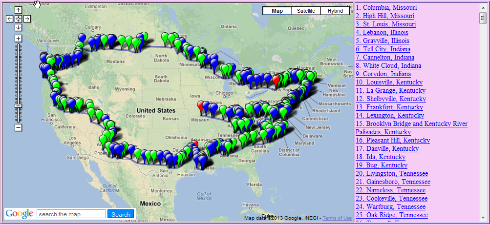 Click on Thumbnail for MapThe land is flat. Very flat. It's humid and there's lots of rice grown here. We are in Kaplan, Louisiana, passing through with William Least Heat-Moon (LHM) as he drives around America. Click on the thumbnail at right to see where Kaplan is located, and bring out your bug spray - there's mosquitos.
Book Quote
"The rice fields began near Kaplan, where the land is less than twenty feet above the sea only thirty miles south, and kept going all the way to Texas."
Blue Highways: Part 3, Chapter 14
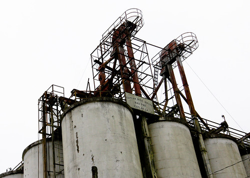 Rice dryers in Kaplan, Louisiana. Photo by Alysha Jordan on Flickr. Click on photo to go to host site.
Kaplan, Louisiana
Since not much comes to my mind from reading the quote, let's see where we go with it. I haven't been in this part of Louisiana, and I don't know much about rice. I know that there isn't much difference in the landscape between New Orleans and Houston along the Louisiana coast - bayous and swamps. It's all part of an immense river basin drainage system.
In times past, before the Army Corps of Engineers put flood control features in place to control the route of the Mississippi River, the Mississippi was like a snake lashing its tail. The mouth of the Mississippi has been in various places over the millennia - near Houston, through the Atchafalaya Basin, presently past New Orleans and down to its mouth at Bird's Foot Delta (or Balize Delta, as some call it).
The river has changed course for a variety of reasons. Along the upper parts of the Mississippi, course changes have occured because of geological obstructions and seismic activity. In 1811-12, the earthquakes along the New Madrid Fault temporarily reversed the flow of the river, carved new lakes and left communities once on the river high and dry when the earthquake moved the course of the river farther to the west or to the east. The mouth has changed it's location too, primarily due to sedimentation. The silt carried by the river gets deposited near the mouth, raising the level of the mouth and causing river to thrash west or east to find a more direct way to the Gulf. This happens every thousand years or so. Currently, it seems to want to shift west. LHM makes reference to this in Blue Highways, when he quotes a Cajun named Cassie Hebert:
"The Atchafalaya's a shorter way to the Gulf than the Mississippi take. Big river gonna find us down here. Corps be damned. One day rain gonna start and keep on like it do sometimes. When the rainin' stop, the Mississippi gonna be ninety miles west of N'Orleans and St. Martinville gonna be a seaport. And it won't be the firstest time the river go running from Lady N'Orleans."
What this has done has created fine land for growing rice. Rice needs wet, wet land to grow, and a belt extending from roughly Lafayette, Louisiana to Corpus Christi in Texas is known for long and medium grain rice, and specialty rices.
My only experience in country similar, perhaps, to the area where Kaplan is located has been in Bangladesh. That whole country is really a river delta and river mouth. On the west, the Ganges flows into Bangladesh, becoming the Padma. It combines with the Jamuna River and takes the name Padma, which then joins the Meghna and takes the Meghna's name, finally emptying into the sea. In this delta land, uncontrolled by humans, floods are yearly and spectacular. The country literally fills up during the monsoon season, leaving only high bits of land and roadways above water. After monsoon season, the waters subside, and rice and other plants grown in paddies and very wet soil thrive. One is literally at the mercy of the elements, and at the mercy of all the insects that thrive in wet climates, and the deadly diseases that they bring.
I don't know if I'll ever get to Kaplan, but I imagine it to be flat, hot in summer, and very steamy. It's climate is probably much like New Orleans and Houston. Kaplan calls itself the "Gateway to Acadiana," and it is the childhood home of country music star Sammy Kershaw. It has an interesting past - even though it is the gateway to Cajun country, its founder was a Jewish rice entrepreneur named Abrom Kaplan. Passing through here will bring you into the Cajun country we've visited with LHM previously. In ensuing years, Kaplan may be tested by possible human-caused events like climate change - should sea levels rise, Kaplan may become ocean-front property, or be underwater. Or, should droughts become more common, rice growing may become more difficult. But until those events become reality, Kaplan can still serve as the entrance, or in our case exit, to Cajun music and culture.
If you want to know more about Kaplan
Institute of Southern Jewish Life: Profile of Kaplan
Kaplan, Louisiana - Gateway to Acadiana
Real Cajun Recipes (Cajun recipe site compiled by three Kaplan natives)
Wikipedia: Kaplan
Next up: Lake Charles, Louisiana