 Click on Thumbnail for MapUnfolding the Map
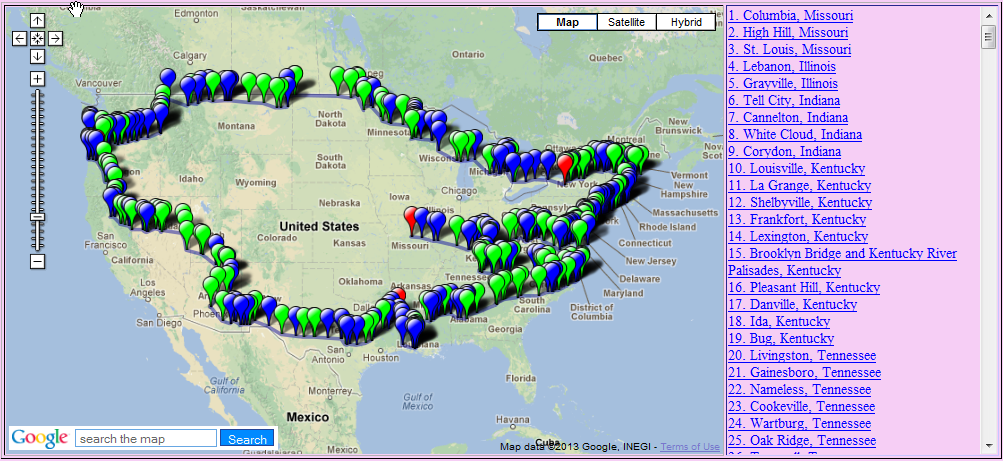
Moving across southern Indiana, we follow William Least-Heat Moon in the initial stages of his journey around America. Click on the thumbnail of the map for visual reference of our location. It's also interactive, if you click on the points. Feel free to follow along the tours on Google Earth, accessible by the link on your left. I have fixed the link problem with the Kerouac Google Earth tour, so check that out as well. As always comments welcome, via the link at the end of this post.
In case you're wondering why sometimes my posts deal with the place, and sometimes not, here is the explanation. I am sharing with you my thoughts as I read, not simply providing information about the places that I am listing. I always give links to learn more about the place, but the posts are simply what comes to my mind after reading the passages. That's what the "tour" in Littourati is about. The words take me on a tour of someplace in my memories or experience, and I share them with you. I hope that through all of these elements, the literature, the maps, and my reflections, the readers of this blog will find something of value.
Book Quote
"On past the old stone riverfront houses in Cannelton, on up along the Ohio, the muddy banks sometimes not ten feet from the road. The brown water rolled and roiled. Under wooded bluffs I stopped to stretch among the periwinkle. At the edge of a field, Sulphur Spring bubbled up beneath a cover of dead leaves. Shawnees once believed in the curative power of the water, and settlers even bottled it. I cleared the small spring for a taste. Bad enough to cure something."
Blue Highways: Part 1, Chapter 5
 Cotton mill, built circa 1854, in Cannelton, IndianaCannelton, Indiana
When I was young, I wondered where the Noyo River came from. It flowed in the summer along the eastern edge of our property with a deep greenish color that made the rocks in its bed look different underneath the water than when I pulled them out. It made little splashes as it rushed over a large pile of buried rocks and emptied into what we called our swimming hole. That section of the river was only half of the piece I knew about about it. It came from somewhere and it went somewhere. I knew where it went, but I didn't know where it came from.
Where did it go? It went on about another 23 miles to its mouth in my hometown. There, the river was wider, deeper, and the greenish tint had a little of the blue about it. It was filled with fishing boats which used it as a safe harbor. Somewhere underneath the masts were the fishing boats of my uncles, the Norcoaster and the Kristy. Just about at the breakwater, the river met the ocean, and green gradually faded into the blue of the Pacific.
Where did it come from? That, I didn't know. I knew that in the winter, the river could be a raging torrent. In the summer, it was a serene placid creek. My father said that it came from springs farther upriver, but I never saw those springs, and I never understood how so much water could originate from what sounded so small: "springs."
I can't remember when I saw my first real spring. Perhaps it was along the Mule Ears Trail in Big Bend National Park, where suddenly in the middle of the desert a blooming oasis appeared, complete with the sounds of numerous insects buzzing around. Perhaps it was on my many hikes in my native Northern California, but I didn't take the time or register what I was seeing.
Yesterday, my wife and I and some friends made a hike in the Sandias, the mountains against which Albuquerque is nestled. We chose to hike on the Armijo Trail because Toro Spring could be found at the end of the trail. Unfortunately, some of my friends weren't in prime hiking shape, and the trail to the spring from the end of the Armijo Trail was a bit rough. I had seen the spring before, basically a hole in the ground, surrounded by some rocks, where water bubbled out of the ground and became a small creek rushing down into the little Armijo Valley. It is a serene placid place. It still amazes me that water just appears out of nowhere, just some hole in the ground, and within a few yards becomes a stream that eventually becomes a river that eventually ends up in one ocean or another.
Springs are awfully symbolic. A life-giving substance, so elemental to existence, welling up from the earth like a gift, quenching our thirst or curing us of maladies, before rushing off to others farther down the line. We drink, we expel it, it goes back into the earth or evaporates into the atmosphere, and becomes once again the water we gratefully drink on a hot day. William Least-Heat Moon, despite the awful taste of the sulphur spring, touches the circle of life even as he starts his circular journey, rushing off down the road like the rivers and streams rush on through life.
A little about Cannelton, a small city of less than 1500 people. The cotton mill in Cannelton was once the largest industrial building west of the Alleghennies. In 1960, a Northwest Orient flight crashed near Cannelton and Tell City, and a memorial has been placed eight miles from Cannelton. While a lot of theories, including a bomb, were looked at, it was eventually determined to be caused by an in-air detachment of the wing due to a flutter.
If you would like more information on Cannelton
Blue Heron Vineyards
Cannelton Foundation
Lafayette Spring
Northwest Orient Airlines Crash Memorial Site
St. Michael Catholic Church
Wikipedia: Cannelton
Wikipedia: Cannelton Cotton Mill
Wikipedia: Cannelton Locks and Dam
Wikipedia: Northwest Orient Airlines Flight 710
Next up: White Cloud, Indiana